Bodie Ghost Town

38.2141° N, 119.0046° W //

Trip Itinerary :  
a. Bridgeport Ca. (4 hours from SF)
b. Bodie CA. 
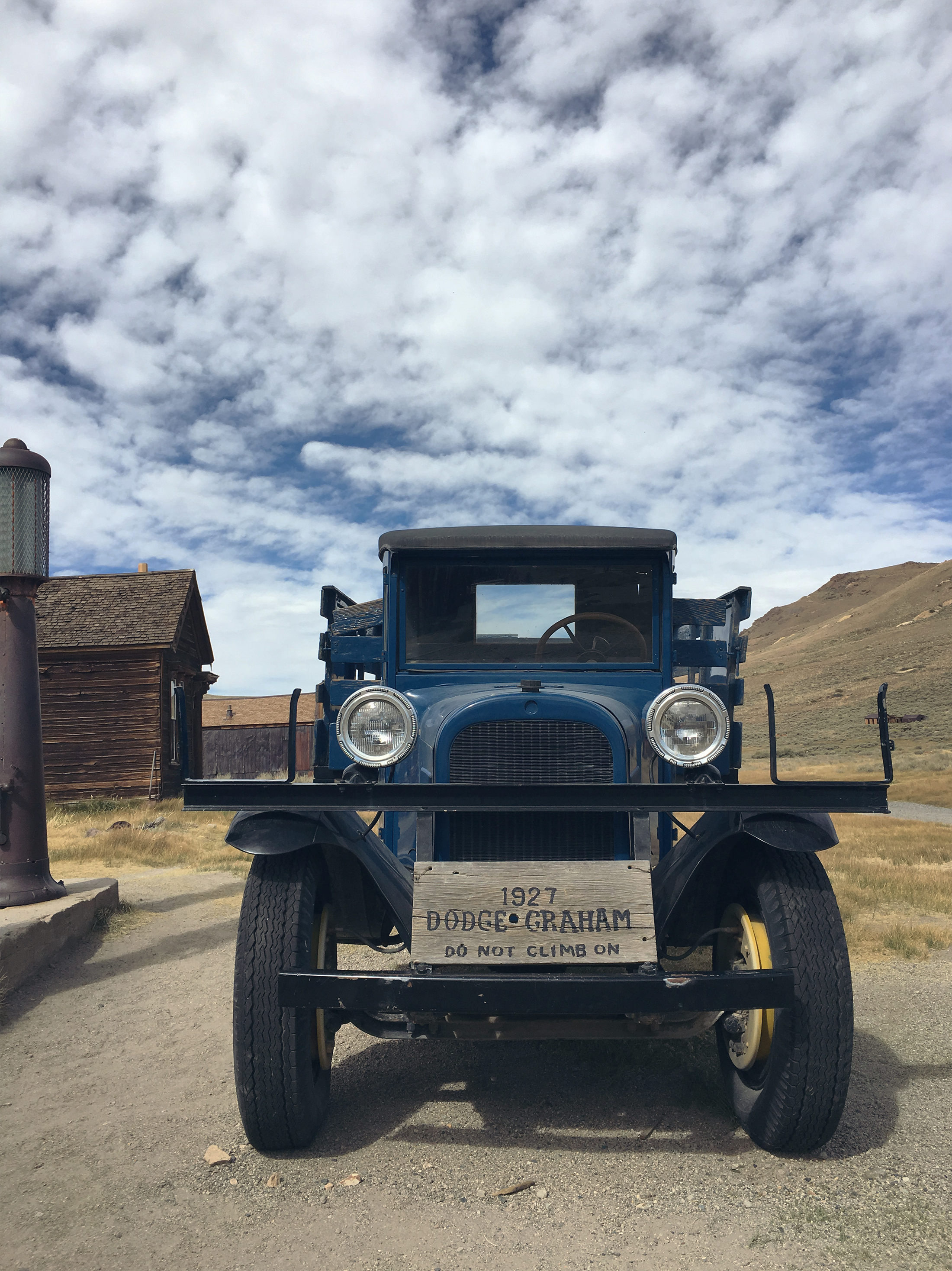
c. Bodie Historic Park (Bodie Ghost Town)

Halloween is just around the corner. Have you decided on what you'll be this year? I have an idea but you'll have to wait to see.

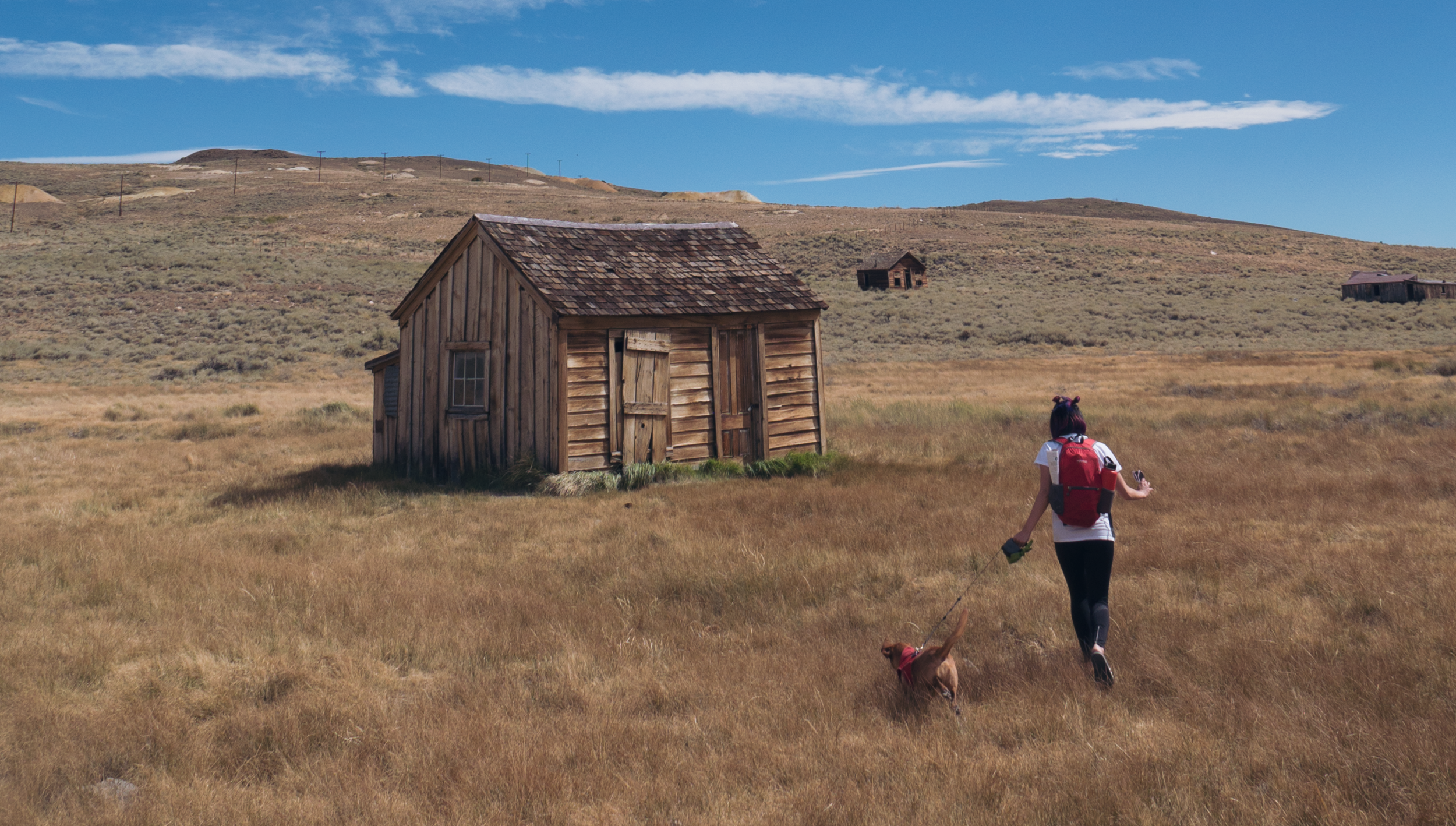
In light of the upcoming holiday. Have fun decorating, costume hunting, and visiting your favorite haunted house. If you're feeling really adventurous. Take a 4 hour drive to Bodie Ghost Town. East of San Francisco. 

What used to be a flourishing gold mining town, now a deserted historical park. It's population was 10,000 people at it's peak. But, after the gold rush most families left leaving their things behind. Today you can see eerie artifacts from the past still hanging around on tables and benches. I think this is a piece of history worth seeing. Check it out.

Ancient Bristlecone Pine Forest

Planning to edit photos and possibly a video from our Eastern Sierras trip. For now check out the Ancient Bristlcone's.

In another time wild dinosaurs, cave men and women probably walked through here. A mixture of desert and forest this place looks bare. Don't be fooled by how small, naked, and bald the trees/landscape look. Some of these bristlecones are more than 4000 years old. 

A Secret camping spot

We found a secret camping spot in Northern California. Its so backcountry. 

Martin, Niroshan and I packed our bikes and rode out early Saturday. We rode south of San Francisco in hopes of scoring a walk-in camp spot. Unfortunately Saturday isn't the best day to try our luck. If you're planning to camp without reservations, come super early Friday for walk-in site. Most campgrounds have 1 or 2 space reserved for this. If you can't make Friday, save yourself the trouble and not go.

Having no available space didn't stop us. We've ridden far. The sun blazing hot. Everyone hungry, and all determine to camp. We made it work. Unfortunately I'm not able to share where this was. It defeats the purpose of going out and exploring with your friends. But, I'll share with you photos and videos of our trip. 

P.S Evident Riders Club is a joke around us trying to catch each others motorcycle mistakes all weekend. I think it might stick. 

I Survived Backpacking Havasupai Arizona

36.255° N, 112.698° W //

Trip Itinerary :  
a. Las Vegas Nevada
b. 4 hr Drive to Supai, Arizona
c. Havasupai Falls

I learned that "Havasu" means blue-green water and "Pai" is people.  According to Wikipedia the Havasupai Tribe have lived in the Grand Canyon for at least 800 years. I'd settle here too now that I've been. I mean, why would anyone want to leave? The water is unbelievably turquoise. You're surrounded by epic waterfalls, lush green jungles, and towering orange canyons. I'm sure food off the land is plenty. I didn't hunt for my food so I dont know. The best part is its hidden deep into the desert, between the canyons, an oasis. It's vibrant, inspirational, and humbling. It's somewhere I want to be again.  

Photos from the trip, and a quick video for Instagram. Follow me on IG. Longer length video this weekend. 

Havasupai in 360°

I have yet to start editing the mountain of footage from Havasupai (pun intended.) I'm terribly sorry to all of my 3 readers... but you're in luck. Here are some awesome 360 photos I took while backpacking. I'll post them sequentially. 

Also, if you're not familiar with the Theta 360.  Its an awesome camera, I highly recommend it. Just as the name suggest, this little device has two 180° optical sensor. Combine, it outputs and stitches a 360° degree photos.  It's not going to be your primary shooter obviously. But definitely a fun camera that adds variety to your trips. 

Click and Pan Guys. Enjoy!


Day 1 : The 10 mile hike in to Havasupai had towering canyons, tinted in hues of orange, red and brown. Sections of the hike are narrow and tall.  It provided awesome cover from the sun.

Anna and I going through Supai Canyons. Headed towards Havasupai campgrounds #theta360 - Spherical Image - RICOH THETA

6 miles in you reach a small village. From the village we hiked another 2 miles to Havasupai Falls. Do you recognized how excited I am. We are close to our camp site.

Made it to the waterfall. Another mile into the camp site. #havasupaifalls #supai #havasupai #theta360 - Spherical Image - RICOH THETA

We camped in the more woodsy area. Next to the cool blue stream leading to Mooney Falls. Some of us in tents. Others in hammocks. 

Our camp. #havasupaifalls #backpacking #havasupai #theta360 - Spherical Image - RICOH THETA

Here's a look into my castle. Its a little over 3lbs. The MSR Hubba Hubba is pretty damn spacious. I bet it can fit 3 little asian person.

Msr Hubba Hubba. A little over 3 lbs. pretty spacious. #msr #backpacking #theta360 - Spherical Image - RICOH THETA

After we settled in. We all went for a swim at Havasupai Falls. This was the closest to camp, and no one was in the mood to hike far. I don't blame them.

Day 1 : We set up camp and immediately went for a swim. I learned that squirrels are ruthless this day. They ate through our bag and stole our snacks! #theta360 - Spherical Image - RICOH THETA

Day 2 : Stopped by Mooney Falls before trecking over to Beaver Falls. 

#MooneyFALLS #theta360 - Spherical Image - RICOH THETA

We did a 8 mile hike round-trip to Beaver Falls.  Unfortunately I didn't get a 360 of Beaver Falls. Here's a group photo on the way back.  You can see a little bit of the falls cascading in the background. 

Post from RICOH THETA. #theta360 - Spherical Image - RICOH THETA

CHASING THE MILKY WAY in big sur CAlifornia

35.970° N, 121.451° W //

Trip Itinerary :  
a. CA Highway 1 South
b. Big Sur, California
c. Cabrillo Highway 1 
d. Prewitt Ridge Road


I've been fascinated by astrophotography for like ever. I thought I needed an expensive camera to be able to do it, so I never tried to learn. Turns out Its quite simple, you can basically use your iPhone if you wanted to. Download the app Slow Shutter for long exposures, and Photo Pills for all your galactic data. Grab a tripod and you're set. I wont' get into any details on how to-- Because Lonely Speck is a great resource if you're interested in learning. Check em out. 

Here are some photos taken with my Panasonic Lumix G7 w/ the 12-35mm f2.8 lens. Taken during sunset, and 4am when the milky way was at it's highest point. Enjoy !

Shout out to my homie Henry Wu for capturing Bentley and I gazing into the sunset. Check him out on IG. P.S congrats on winning the Alite Photo Contest. 

Currently in Canada

Its been awhile since I've updated the blog. I've been quite busy with work and travel. Recently I went to Hawaii for a memorial, Big Sur to camp, and currently in Canada for Anna's birthday. I have so much editing to do, and can't wait to get to them. I'll just need to make the time. For now, enjoy this photo I took at Joffre Lake.

23.424° N,43.169° W Lanikai Pill Box

The time difference between home and Oahu makes me feel so productive. My internal clock think it's 8am, when it's really 5am. The locals are in disbelief I'm up and active. 

This morning a group of us drove out to the Lanikai Pillbox Trails to sweat off the Ciroc from the night before. First full day in Oahu and we're starting strong. Here's a short edit taken from my Phantom. I'll make a longer edit when I'm back, and not on vacation. Enjoy

38.9616° N, 120.1015° W | Rubicon Trail Tahoe

Trip Itinerary :  
a. Highway 50 - South Lake Tahoe
b. Highway 89- Emerald Bay Parking Lot

The thing about nature is I'm surrounded by all of it'g glory while hiking. Its acoustics, flavors and visuals are stimulating. I get the same feeling while riding, Its reason I love the open road. On a motorcycle my senses are heighten. You're aware of smells and sounds you generally tune out. If only for a minute, or an hour, Its all worth it. 

Here is a short clip of the Rubicon Trail Colin and I did this past weekend. Enjoy. 

Lookout on Rubicon Trail

This photo was taken by my homie Colin on Rubicon Trail. Views like these energize me. It fuels my desire to adventure more. I'm reminded how beautiful and grand mother nature is, and that there is so much more to discover.

We did a 13.2 mile hike that day. Colin, Bentley and I woke up early (4 A.M) hoping to score a permit to hike Mt. Tallac. An intensive 20 mile hike round trip. Unfortunately we weren't that lucky. So we did Rubicon Trail instead. I'm currently editingfootage from our hike. Planning to share something here before I leave for Hawaii in two days.

37.5646° N, 122.5140° W | GRAY WHALE COVE

Trip Itinerary :  
a. Highway 1 - Pedro Point
b. Highway 1 - Shelter Cove
c. Highway 1 - Grey Whale Cove

Sorry to disappoint anyone expecting to see gray whale's in this video. There were no grey whales swimming around while I was there. 

If you're serious about whale watching though. Here is a fun fact. 20,000 Grey Whales migrate through the Pacifica area annually. Starting February and ending in April. Have your binoculars ready and plan for it next year. It's probably too late now, April is about to be over. 

I love riding out to Grey Whale Cove. Its next to Devils Bunker, and only 20 minutes from my house. This is an awesome place for a short after work ride. One that I do very often. There are plenty of hikes, and breaks to surf around there. 

42.6689° N, 72.2050° W | SPIRIT FALLS

Trip Itinerary :  
a. Highway 84 E - Bridge of Gods
b. Columbia Gorge WA - Spirit Falls

While back in Oregon for my pop's birthday weekend I was hoping it was still cold enough to see a bit of snow, some icicles or at least some dew covered plants at Spirit Falls. 

Being an Oregon native I've seen most of the state during the Spring and Summer seasons. I've always been a chicken when it comes to cold weather, so I hibernated in the winter playing games. It's not until recently that I became fascinated with the idea of seeing parts of Oregon at the peak of winter. I was inspired when a buddy showed me a photo of Crater Lake frozen, covered in white powder and the water a beautiful turquoise hue. So this year I made a list of places I'd like to see, and Spirit Fall's was one of them. Unfortunately we're at the cusp of spring so excuse the lack of snow photos. 

The hike is a short climb down. About 15-20 minutes of scaling a steep and rocky mountain side, and then a 10 minute hike in depending on your pace. Every so often a "Private Property, No Trespassing" sign is posted stating you will be prosecuted in neon green.  After seeing a few of those and some abandoned washing machines covered in bullet holes. A few of us became discouraged, and frankly scared. Don't judge me. Because the trail was unmarked it took longer to find, often we felt lost. Uncertain if we're headed the right way. A good north star is to follow the creek, or the acoustics from the thundering falls as you get closer.  Trust me its worth the scare and the climb.  

CALIFORNIA COASTING

I've forgotten how thrilling and free it is to ride as I coast the newly paved roads on Highway 1, I'm reminded how infrequent we inspire our senses. We spend our days in closed boxes. I miss the rich, delicate, earthy smells. The wet gravel from the rain. The sweet oceanic air. The salty seasoning it leaves on your lips. I am free from windows. Free from doors. The Solidarity. The Freedom. I miss the acoustics caused by ther wind, the road and earth harmonizing. I wish you heard it. I hope one day you will. The joy of riding. 

Trip Itinerary :  
a. Highway 1 - Pacifica Pier
b. Highway 1 - Devils Slide Trail
c. Highway 1 - Devils Slide Bunker