
I'm back in SF and found a bit of time to cut this 60 seconds of Hawaii. Check it out.
OLD CO-WORKERS, NEW ADVENTURES
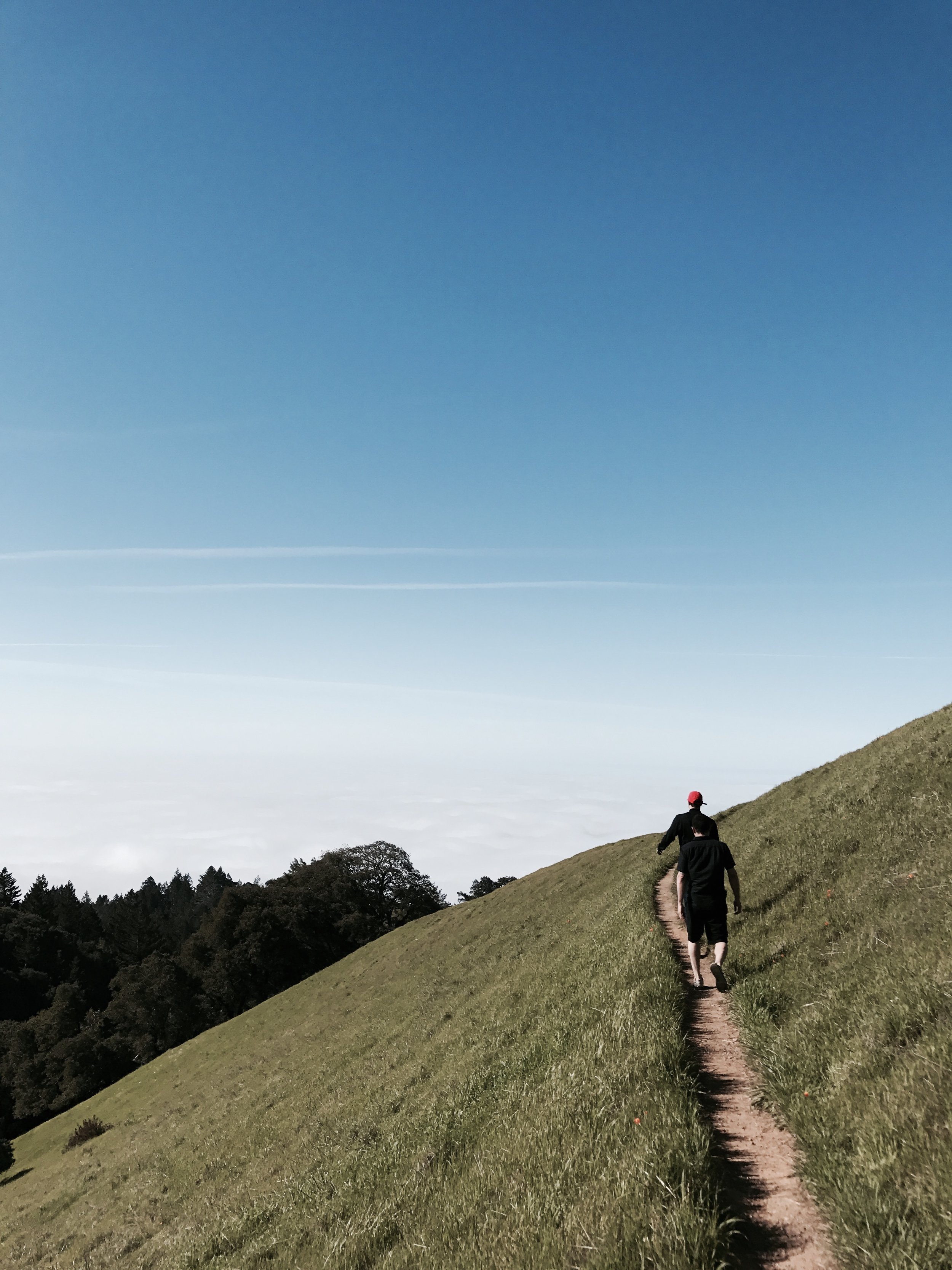
As usual, Sunday equals Funday, So I met up with some familiar faces. I use to work with these guys/gals @ Matter Global. We arrived early to catch the clouds blanketing the horizon. I bet it's epic during sunset. I can't believe this place is so close to home, I'll have to ride my motorcycle up here soon. Its one of the places I like to frequent, but feel like I never see it all. There is always something new each time I come. Video coming soon.


Fun At Funston
Just a little drive past Ocean Beach in SF. Depending on which direction you drive on highway 1, is Fort Funston Golden Gate National Conservancy. Primary a dog park, but expect hang gliders, surfers, and your typical SF breeze. The views and hike here is amazing. I would recommend to anyone with a pup. I've known of the park but have never gone, San Mateo has plenty of awesome dog parks so I don't venture into SF much. I'm so happy I did, I like filming on an overcast day.


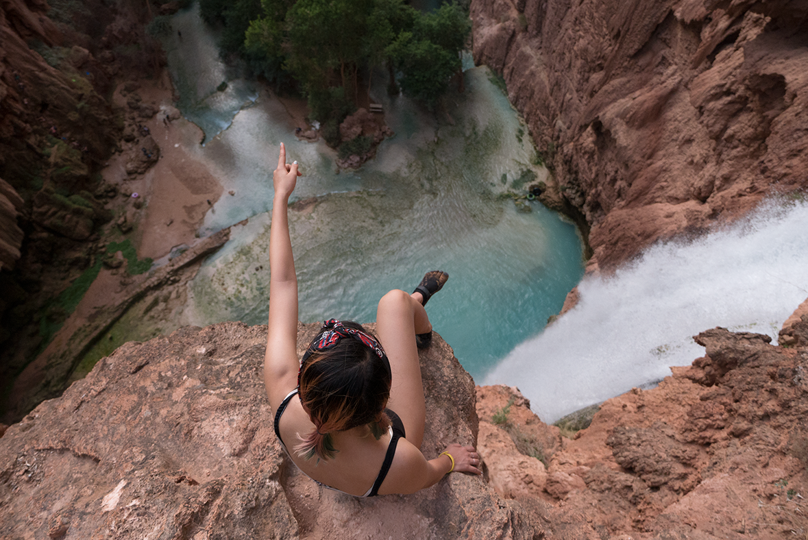
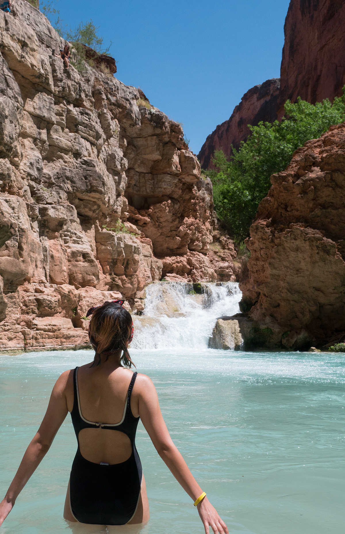
I Survived Backpacking Havasupai Arizona
36.255° N, 112.698° W //
Trip Itinerary :
a. Las Vegas Nevada
b. 4 hr Drive to Supai, Arizona
c. Havasupai Falls

I learned that "Havasu" means blue-green water and "Pai" is people. According to Wikipedia the Havasupai Tribe have lived in the Grand Canyon for at least 800 years. I'd settle here too now that I've been. I mean, why would anyone want to leave? The water is unbelievably turquoise. You're surrounded by epic waterfalls, lush green jungles, and towering orange canyons. I'm sure food off the land is plenty. I didn't hunt for my food so I dont know. The best part is its hidden deep into the desert, between the canyons, an oasis. It's vibrant, inspirational, and humbling. It's somewhere I want to be again.
Photos from the trip, and a quick video for Instagram. Follow me on IG. Longer length video this weekend.


Havasupai in 360°
I have yet to start editing the mountain of footage from Havasupai (pun intended.) I'm terribly sorry to all of my 3 readers... but you're in luck. Here are some awesome 360 photos I took while backpacking. I'll post them sequentially.
Also, if you're not familiar with the Theta 360. Its an awesome camera, I highly recommend it. Just as the name suggest, this little device has two 180° optical sensor. Combine, it outputs and stitches a 360° degree photos. It's not going to be your primary shooter obviously. But definitely a fun camera that adds variety to your trips.

Click and Pan Guys. Enjoy!
Day 1 : The 10 mile hike in to Havasupai had towering canyons, tinted in hues of orange, red and brown. Sections of the hike are narrow and tall. It provided awesome cover from the sun.
Anna and I going through Supai Canyons. Headed towards Havasupai campgrounds #theta360 - Spherical Image - RICOH THETA
6 miles in you reach a small village. From the village we hiked another 2 miles to Havasupai Falls. Do you recognized how excited I am. We are close to our camp site.
Made it to the waterfall. Another mile into the camp site. #havasupaifalls #supai #havasupai #theta360 - Spherical Image - RICOH THETA
We camped in the more woodsy area. Next to the cool blue stream leading to Mooney Falls. Some of us in tents. Others in hammocks.
Our camp. #havasupaifalls #backpacking #havasupai #theta360 - Spherical Image - RICOH THETA
Here's a look into my castle. Its a little over 3lbs. The MSR Hubba Hubba is pretty damn spacious. I bet it can fit 3 little asian person.
Msr Hubba Hubba. A little over 3 lbs. pretty spacious. #msr #backpacking #theta360 - Spherical Image - RICOH THETA
After we settled in. We all went for a swim at Havasupai Falls. This was the closest to camp, and no one was in the mood to hike far. I don't blame them.
Day 1 : We set up camp and immediately went for a swim. I learned that squirrels are ruthless this day. They ate through our bag and stole our snacks! #theta360 - Spherical Image - RICOH THETA
Day 2 : Stopped by Mooney Falls before trecking over to Beaver Falls.
#MooneyFALLS #theta360 - Spherical Image - RICOH THETA
We did a 8 mile hike round-trip to Beaver Falls. Unfortunately I didn't get a 360 of Beaver Falls. Here's a group photo on the way back. You can see a little bit of the falls cascading in the background.
Post from RICOH THETA. #theta360 - Spherical Image - RICOH THETA
38.9616° N, 120.1015° W | Rubicon Trail Tahoe
Trip Itinerary :
a. Highway 50 - South Lake Tahoe
b. Highway 89- Emerald Bay Parking Lot
The thing about nature is I'm surrounded by all of it'g glory while hiking. Its acoustics, flavors and visuals are stimulating. I get the same feeling while riding, Its reason I love the open road. On a motorcycle my senses are heighten. You're aware of smells and sounds you generally tune out. If only for a minute, or an hour, Its all worth it.
Here is a short clip of the Rubicon Trail Colin and I did this past weekend. Enjoy.
Lookout on Rubicon Trail
This photo was taken by my homie Colin on Rubicon Trail. Views like these energize me. It fuels my desire to adventure more. I'm reminded how beautiful and grand mother nature is, and that there is so much more to discover.
We did a 13.2 mile hike that day. Colin, Bentley and I woke up early (4 A.M) hoping to score a permit to hike Mt. Tallac. An intensive 20 mile hike round trip. Unfortunately we weren't that lucky. So we did Rubicon Trail instead. I'm currently editingfootage from our hike. Planning to share something here before I leave for Hawaii in two days.

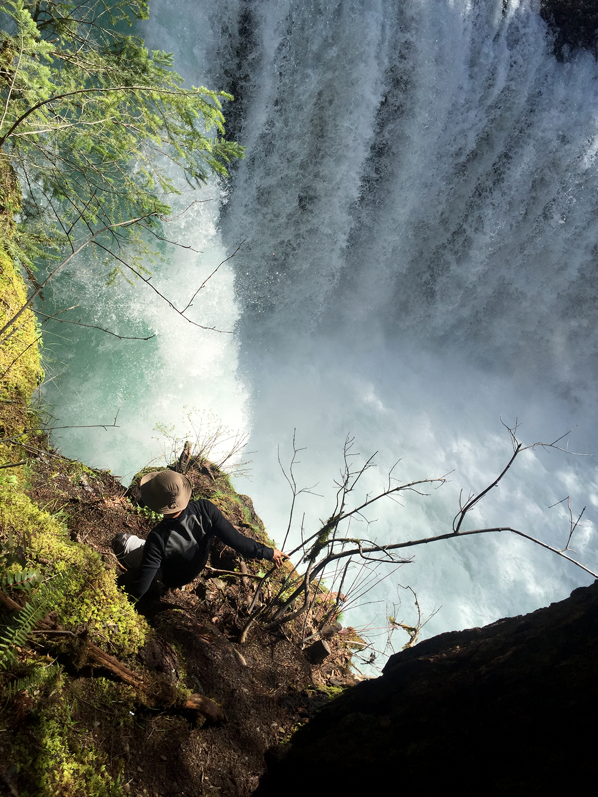
42.6689° N, 72.2050° W | SPIRIT FALLS
Trip Itinerary :
a. Highway 84 E - Bridge of Gods
b. Columbia Gorge WA - Spirit Falls
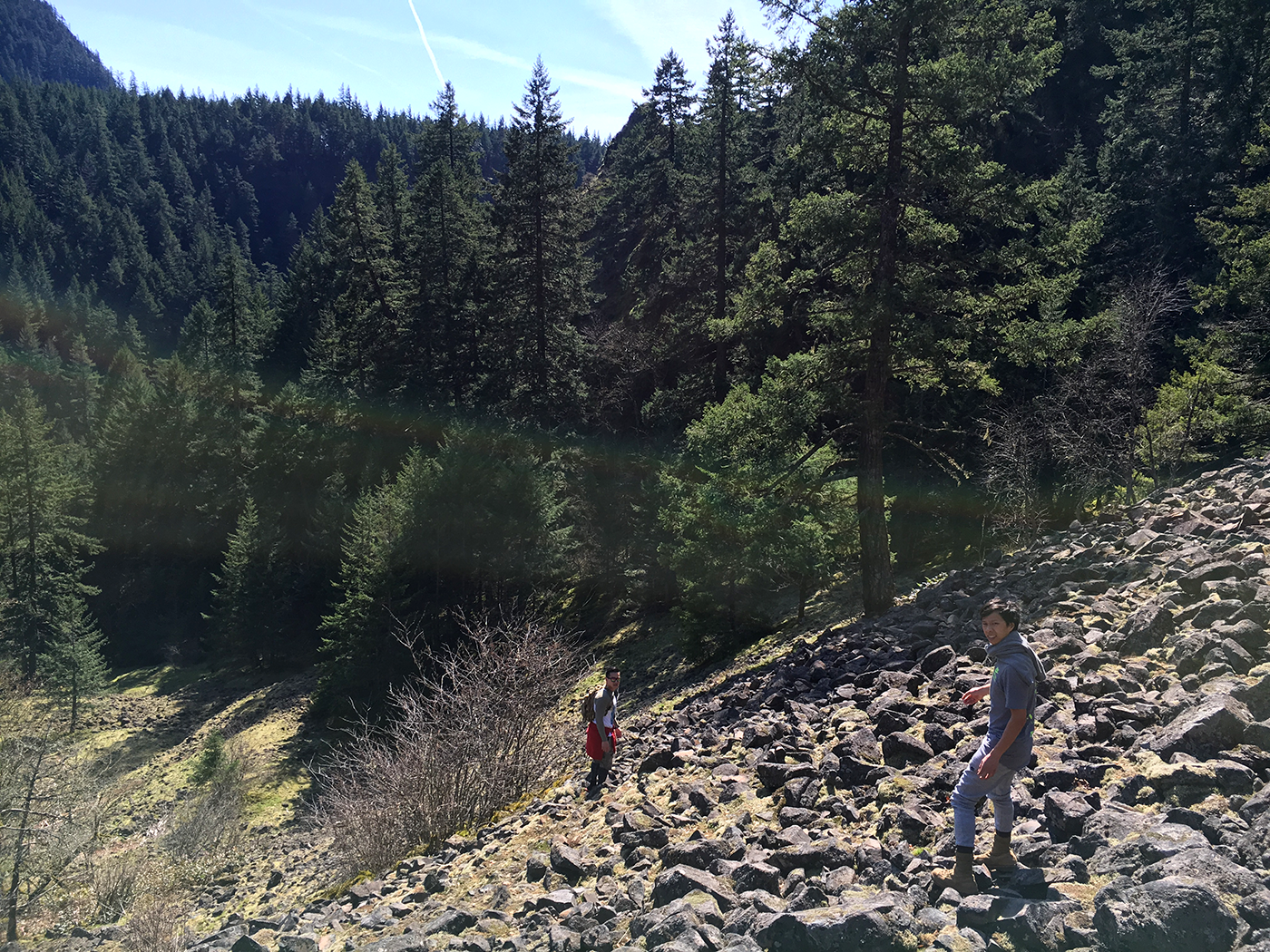
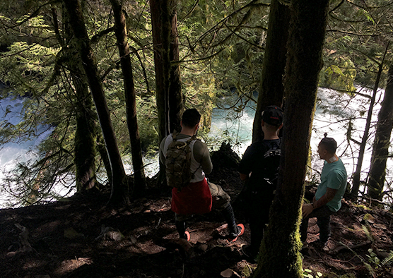
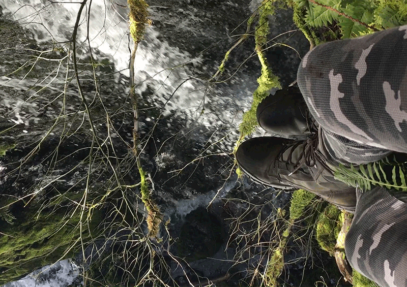
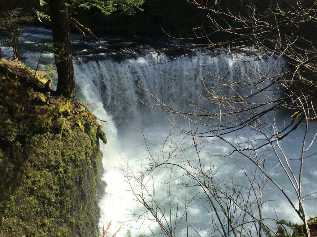
While back in Oregon for my pop's birthday weekend I was hoping it was still cold enough to see a bit of snow, some icicles or at least some dew covered plants at Spirit Falls.
Being an Oregon native I've seen most of the state during the Spring and Summer seasons. I've always been a chicken when it comes to cold weather, so I hibernated in the winter playing games. It's not until recently that I became fascinated with the idea of seeing parts of Oregon at the peak of winter. I was inspired when a buddy showed me a photo of Crater Lake frozen, covered in white powder and the water a beautiful turquoise hue. So this year I made a list of places I'd like to see, and Spirit Fall's was one of them. Unfortunately we're at the cusp of spring so excuse the lack of snow photos.
The hike is a short climb down. About 15-20 minutes of scaling a steep and rocky mountain side, and then a 10 minute hike in depending on your pace. Every so often a "Private Property, No Trespassing" sign is posted stating you will be prosecuted in neon green. After seeing a few of those and some abandoned washing machines covered in bullet holes. A few of us became discouraged, and frankly scared. Don't judge me. Because the trail was unmarked it took longer to find, often we felt lost. Uncertain if we're headed the right way. A good north star is to follow the creek, or the acoustics from the thundering falls as you get closer. Trust me its worth the scare and the climb.


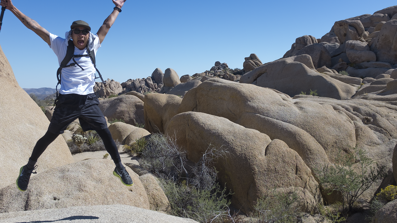
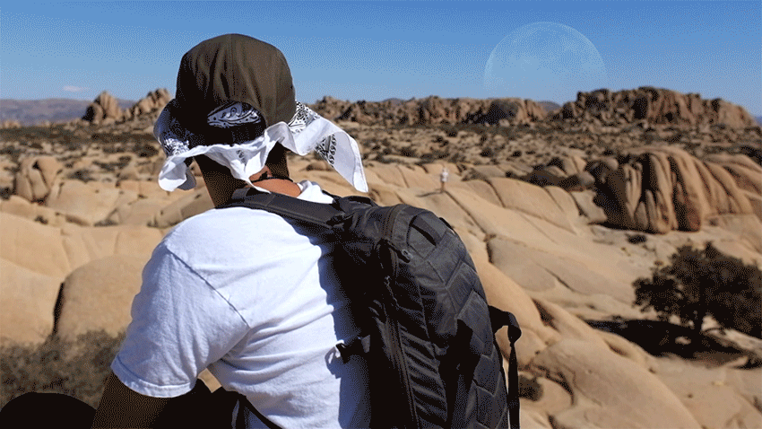
Mars Like

Last weekend Colin, Anna and I drove down South to see my buddy David. I needed to grab my groomsmen suit for his wedding, so I thought, why not squeeze in a short hike in the desert and ATV'ing at the dunes while we're down there. I haven't gotten around to editing photos at the dunes, but enjoy the ones taken in the desert. The moon came out to play.
33.7884° N, 115.8982° W


California Desert (ig edit)
Enjoy this 15 second teaser I cut for Instagram . I'm working on a full edit, and will be heading to Portland to see fam and sister's kids for Halloween. So will be done with the video next week.